
|
||||||||||||||
|
Home | Spelletjes | Uitvindingen | Gps | Scouting | Meteo | Computers |
||||||||||||||
| Gps / Illustrations | Menu | |||||||||||||
Some Gps IllustrationsInteresting PicturesThe first trackWhen I bought my last Gps, a simple Garmin Geko, I noticed there were already three points registered in this machine. I investigated this intriguing little track. The first point was N38.8555,W94.7790 (map) which is in Olathe, 30 kms south of Kansas City in the US. This point is way off from the other two points, that were taken just a few seconds after. So it is certainly not correct. The two other points were both at N25.0620,E121.6402 (map) which is a village called Sijhih in the north of Taiwan, in a building with a white roof which looks like a factory. The spot is marked here with a cross-hair marker, slightly off-center. Very probably this is the place where my Gecko was manufactured and fist switched on! 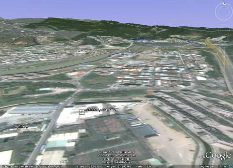 Just 83 days, 16 hours and 38 minutes later this machine was in my possession. Altitude mapOf all my hikes I keep he track data in full resolution so that I can rerun everything at home out of my arm-chair. The software I use, Gartrip.de conveniently converts the track into Google-maps kml-files (see the example below), and it can make interesting altitude maps. Awkwardly the maker of Gartrip does not advertise this feature, so I will... The map below is made during a 7 days hike in the French Alps from Lake Geneva to the Mont Blanc, heading south. After 7 days I had to quit because of bad weather, I only had a far view to the Mont Blanc that year.  Each color is a different day. The Gartrip software adds the nearby waypoints as markers on this map. Note the green arrow which I added in the graph to mark the place and direction in which the picture below was shot. Google EarthDuring this same hike I descended the Pas de Bosse (1816m), and this is the picture I took up there. Below is the Abondance Valley, and in the distance the Mont Blanc mountain range. 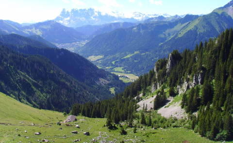 I exported the track to kml file using Gartrip, and imported this file into Google earth. This is the result. 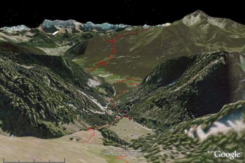 The latter image is produced by Google Earth with my computer. In red is the track that I was going to walk the next two days. The track was recorded in my Gps, converted to kml-format and then imported into Google Earth. (The picture above is taken by screenshot and then reduced in size, resulting in a rather blurred image. The original is much better!) Note the striking similarities. Makes you wonder why not to stop traveling, and do simulated trips instead... The picture was taken on 7-7-07 at this place Altitude measurementThere is much discussion about the accuracy on altitude measurement of a Gps. Here is my little experiment: During a hike through the Vosges in Eastern France I mounted Le Schneeberg. There happened to be a calibrated altitude gauge there. So I put my Gps next to it and made this picture. 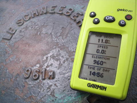 Actually I had to have the Gps stabilize for about 20 minutes until it reached this accuracy and fluctuation less then a few meters. Excellent reception of satellites was certainly a helpful factor. The picture was taken just before 3 pm at this place While moving my experience is that the error in altitude rarely exceeds about three times the given accuracy (read from the display). In ideal conditions the average error in altitude is about 15 meters (by a given accuracy of 5m). Flight RecordingThe other day I flew back to Schiphol, Amsterdam airport. Of course I left my Gps switched on, and recorded the flight. Here Google Earth was my friend again, I imported the track and got this view. Note how well Google Earth displays altitude. 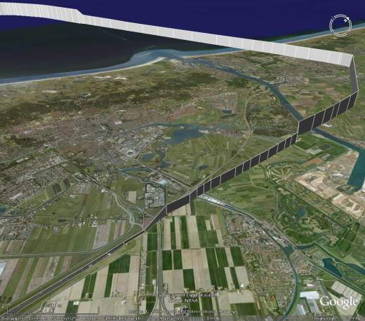 These actual flight data shows the plane coming from the North Sea, landing over IJmuiden (port of Amsterdam), circling toward Schiphol and descending toward the landing strip. The city in the center is Haarlem. On our back lies Amsterdam. Links
Readers comments
|
Departementen Gps artikelen |
|||||||||||||
| Top | Bekijk | Afdrukken | Zoek Pagina gewijzigd op 04 december 2014 om 10:48 | ||||||||||||||
